I grew up around there (Parklawn/Berry Road). How did that planned inclusive community space turn into a developer’s bonanza, coat tailing on dollars earmarked for community well-being? How did the big intentions for public space morph into locking large frontages of Lake Ontario away from public access?
As a long time resident of that area, I am angry about the silent swept under the rug corruption, and you should be too. All I am seeing is commercial condo developments.
Very expensive.
What happen to the planned 15% for affordable housing?
As of early 2026, the condo market prices reflect the area’s premium location. The median sales price for condos in Humber Bay are around $648,000, most in the $500,000 to $750,000 range. Over the past year, the average condo sale price is $536K
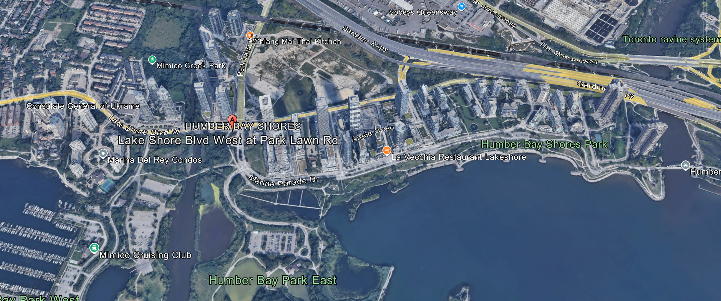
The transformation of Toronto’s Lakeshore Motel Strip—now Humber Bay Shores—from a proposed $3 billion mixed-use redevelopment in the 1980s to a cluster of premium condo towers involved a series of planning missteps, regulatory overrides, and market-driven shifts that prioritized private profits over public goals.
While the original vision emphasized community inclusivity, environmental improvements, and some affordable housing elements, the outcome has been a high-density residential enclave with limited affordability and strained infrastructure.
The key failures in the pipeline, based on historical plans and analyses, and the fate of that $3 billion figure.
The Original Vision: A Public-Private Partnership with Inclusive Elements
In the late 1980s, amid urban decay in the Motel Strip (a stretch of post-war motels along Lake Shore Boulevard West in Etobicoke, known for seedy activities like drug use and prostitution), a $3 billion redevelopment plan was unveiled as part of broader waterfront renewal efforts.
This was influenced by the Royal Commission on the Future of the Toronto Waterfront, which pushed for integrated urban communities.
By 1991-1992, the City of Etobicoke (pre-amalgamation) adopted the Motel Strip Secondary Plan, which formalized the blueprint.
Key elements included:
Mixed-use development: A waterfront community blending residential, commercial, recreational, and open spaces, with a cap of about 3,193 residential units (up to 165 units per hectare) to avoid over-densification.
Community inclusivity: Public consultations via community meetings, emphasis on pedestrian-friendly design, visual access to the lake, and facilities like schools, parks (including 6.5 hectares of waterfront amenities), docking, and a year-round public attraction.
It aimed to connect to nearby parks and improve transit/pedestrian links.
Affordable housing provisions:
While not mandating quotas, the plan applied broader Official Plan policies encouraging a “range of unit types, sizes, tenure, and costs” to promote inclusivity.
It also allowed up to 350 “special units” for seniors, with density incentives under Section 37 agreements (e.g., bonuses for community benefits). Monitoring of applications was required to track affordability.
Implementation:
A public-private model where the city expropriated land in the 1990s for public parks and amenities (freeing up waterfront from motels), while private developers handled building on “net sites” (after dedications for roads, parks, etc.).
Funding came from private contributions, parkland dedications (0.5-1.0 ha per 300 units), cash-in-lieu payments, and density transfers. Holding by-laws ensured infrastructure readiness before approvals.
The $3 billion was framed as the estimated total investment for the project, not a direct public payout—think projected costs for land assembly, infrastructure, and private builds over time.
What Broke in the Pipeline: Key Mess-Ups and Shifts to Premium Condos
The plan derailed through a combination of regulatory weaknesses, market pressures, and planning silos, turning the area into a “premium private condo development campus” with over 15,000 units built or planned (far exceeding the original cap), mostly market-rate luxury towers.
Here’s where things went seriously off the rails:
Regulatory Overrides and Developer Appeals (Early 2000s Onward):
The Ontario Municipal Board (OMB, now replaced by the Ontario Land Tribunal) played a pivotal role in accelerating and altering development.
In 2006, the OMB rezoned industrial land west of Park Lawn Road from employment to mixed-use residential after developer appeals, allowing over 3,200 unplanned units.
* This was based on the site’s non-viability for offices without a promised GO Transit station (which never materialized).
* The city opposed it due to inadequate infrastructure, but the OMB prioritized developer arguments, bypassing local planning controls.
* This set a precedent for rampant approvals, leading to taller, denser towers (e.g., 66-story structures) focused on high-end condos to maximize profits on waterfront views.
*** Failure to Enforce Affordability and Inclusivity:
– While the Secondary Plan encouraged affordable options, there was no strong mandate or enforcement mechanism.
– Developers opted for premium units (median condo price now ~$648,000), resulting in a neighborhood lacking purpose-built rentals or affordable housing.
– Community inclusivity faded as the area attracted young professionals and investors, not diverse incomes.
– Critics note this reflects broader civic attitudes squandering finite waterfront for private gain, with little retail or community spaces in the “grim, uncoordinated” architecture.
Ontario’s housing crisis timeline highlights how 1990s-2000s policy shifts (e.g., reduced provincial funding for social housing) exacerbated this nationwide.
– Infrastructure and Planning Silos:
** Land-use planning outpaced transportation, leaving residents in traffic hell.
** The area has only two access roads (Park Lawn and Lake Shore), with no quick downtown links—buses and streetcars crawl in gridlock.
** Promised projects like a Park Lawn GO station ($178M, still under review),
** Legion Road extension (approved 20+ years ago, unfinished), and Waterfront LRT ($2B unfunded plan) stalled due to coordination issues among the city, TTC, Metrolinx, and province.
** Growth doubled the population unexpectedly, with infrastructure “barely keeping pace.”
** Retrofitting transit after people settle (and buy cars) is notoriously hard and costly.
** Market and Economic Pressures:
The early 1990s market crash delayed assembly of motel sites, stalling progress until the 2000s condo boom.
** Developers like Empire Communities focused on “tall, slim towers” to preserve views and boost sales, evoking motel names (e.g., Shore Breeze Drive) but ignoring historical preservation.
** This aligned with Toronto’s broader shift to vertical living, but without checks, it became a “condo canyon” rather than a balanced community.
** These issues aren’t unique—Toronto’s history includes similar “disasters” like over-densification without support, as seen in other waterfront projects.
Where Did the $3 Billion Development Dollars Go?
There’s no evidence of a single $3 billion public pot being “spent” or misappropriated—it was always a projected total value for the redevelopment, encompassing private investments, land costs, and public amenities over decades.
Private developers footed most of it through condo builds, with contributions to public elements (e.g., parks, roads) via agreements—developers like Empire funded parkland since the city couldn’t.
Actual investment has ballooned far beyond:
Residential units alone are valued at ~$10.4 billion (at $650K average per unit across 16,000+), plus costs for infrastructure like the $4M Humber Bay Arch Bridge.
Public funds went to expropriations in the 1990s and ongoing (unfunded) transit plans, but the bulk was private capital turning motels into profitable condos.
Lessons from Humber Bay Shores: A Cautionary Tale for Toronto’s Waterfront Future
In hindsight, the “mess-up” in Humber Bay Shores stems from weak safeguards against unchecked developer influence and disjointed governance—hallmarks of Toronto’s broader growth story, where ambitious visions often collide with regulatory loopholes and fragmented planning.
What began as a balanced, community-focused redevelopment in the 1980s devolved into a premium condo enclave through OMB overrides, inadequate enforcement of affordability mandates, and infrastructure planning that lagged far behind rapid densification.
This isn’t an isolated incident; it’s symptomatic of systemic issues in Ontario’s urban development landscape, where private profits frequently eclipse public interests, leading to overbuilt neighborhoods strained by traffic, limited transit, and a lack of diverse housing options.
Toronto’s history is littered with similar tales—from the Gardiner Expressway’s divisive legacy to the Harbourfront’s commercialization—highlighting a pattern of grandiose promises undermined by poor coordination among municipal, provincial, and private stakeholders.
Now, here’s an intriguing consideration that sharpens this case study into a prescient warning:
The Ontario government is currently forging ahead with its bold, multi-billion-dollar redevelopment of Ontario Place, a 155-acre waterfront site just east of Humber Bay.
Announced under Premier Doug Ford’s administration, the plan envisions transforming this iconic 1970s landmark—originally a modernist showcase of public recreation—into a “world-class tourism destination” featuring a massive private spa and waterpark operated by Austrian firm Therme, alongside the relocation of the Ontario Science Centre and a controversial $400-million taxpayer-funded parking garage.
Total projected costs have ballooned to at least $2.2 billion, with significant public funds subsidizing private elements, echoing the Motel Strip’s shift from inclusive ideals to profit-driven outcomes.
How many of the pitfalls from Humber Bay Shores are poised to repeat here?
Already, we’re seeing familiar red flags:
The Rebuilding Ontario Place Act of 2023 exempted the project from key environmental assessments, heritage protections, and planning approvals—much like the OMB’s developer-friendly rezonings that supercharged condo towers in Etobicoke.
This has sparked fierce opposition from groups like Ontario Place Protectors, who argue it prioritizes corporate interests over public access and ecological integrity, potentially leading to another “condo canyon” scenario with limited affordability or community input. Infrastructure concerns loom large too;
— Without robust transit upgrades, the site could exacerbate downtown gridlock, mirroring Humber Bay’s access woes.
And as the Supreme Court of Canada prepares to hear a constitutional challenge to the act in early 2026, the project’s fate hangs in the balance, underscoring the same disjointed governance that allowed Humber Bay’s original vision to fray.
For real estate investors and residents alike, these parallels serve as a stark reminder:
Waterfront redevelopment holds immense potential, but without stronger accountability—such as mandatory affordability quotas, transparent public-private partnerships, and integrated infrastructure planning—history risks repeating itself.
As Ontario Place’s saga unfolds, will Toronto learn from Humber Bay Shores, or will we witness another chapter in the city’s tale of missed opportunities?
Read my detailed analysis of the looming Ontario Place re-development fiasco here: